|
|

- Earthen
Cover Design, Casa Grande, Arizona
Situation
The site, an Arizona Water Quality Assurance Revolving Fund
site, is approximately 5 miles northwest of Casa Grande, Arizona.
The former chromium disposal pits occupied a 70-foot by 80-foot
area located in the center of the 2.5 leased acres. The area
impacted by the disposal of chromium solutions into these pits
covered approximately 20,600 square feet. Soil with chromium
concentrations approaching or exceeding the 1,500 milligrams
per kilogram action level established by ADEQ are contained
in this area.
Hydro Geo Chem's Approach
 The
cover was designed for the site to provide the following controls: The
cover was designed for the site to provide the following controls:
1) Contaminant containment: Containment of the soils containing
chromium concentrations equaling or exceeding the action levels
established by ADEQ by covering the impacted area.
2) Moisture control: Prevent precipitation falling on the cover
from ponding and infiltrating into the contamination zone. Provide
sufficient cover thickness to allow evapotranspiration to deplete
excess moisture.
3) Flood and erosion control: Construct an engineered diversion
ditch, grade area, and provide soil-cemented and rock covers
to prevent shifting arroyos from inundating the cover and loss
of cover material by erosion.
4) Dust control: Vegetation to control dust from the cover and
surrounding areas.
5) Capillary rise control: Construct the cover with a capillary
barrier to eliminate the upward movement of contaminants to
the land surface by capillary rise.
The following tasks were completed to obtain the desired controls:
• The pits were filled in to match the original grade which
slopes approximately 1% to the south-southwest.
•
The soils and fill were compacted to minimize settling of the
cover.
A 1-foot-thick capillary barrier consisting of river-run gravel
extended across the entire area of soils equaling or exceeding
the ADEQ action level. The gravel material met the following
grain size specifications:
• 95 to 100% passing 1-inch sieve
• 0 to 20% passing ½-inch sieve
• 0 to 20% passing -inch sieve
High survivability filter fabric (geotextile) was placed above
and below the gravel layer to prevent the layer from being infiltrated
with fine grain-size soil material. The capillary barrier controls
capillary rise. The barrier and earthen cover is of sufficient
areal extent to contain the impacted soils.
A soil cover with a minimum thickness of 32 inches was placed
on top of the capillary barrier. Infiltration analyses of the
earthen cover borrow material indicated that 32 inches was sufficient
to allow evapotranspiration to deplete excess moisture before
it could infiltrate into the impacted soil. The final grade
of the cover prevents surface water from ponding or inundating
the site and directs surface water downgradient of the cover.
The engineered drainage ditch was designed with sufficient capacity,
slope, and durability to contain and drain surface waters during
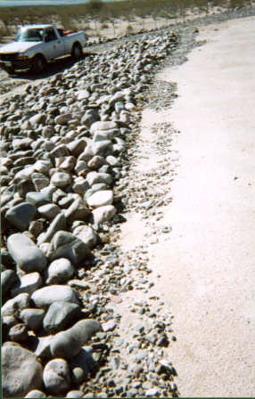
large flood events downslope of the cover. A 6-inch-thick cement
layer was constructed on the cover edge of the diversion ditch
to provide erosion control. This, along with the gradual 4:1
slope of the cover edge, was designed to minimize erosion. The
disturbed areas were seeded with hydromulch to control dust
and minimize erosion.
Results
A recent survey confirmed the following design components:
•
The subgrade is at a similar level and grade as the undisturbed
area. No depressions are present across the impacted area and
the slope is 1% grade to the south-southwest.
• The impacted area is covered by the capillary barrier
and the capillary layer is approximately 1 foot thick.
• The concrete bank protection is constructed at 4:1 slope,
the toe is approximately 3 feet below the natural grade, and
the bank protection has approximately 2 feet of freeboard.
• The earthen cover is at least 32 inches thick over the
capillary barrier and does not have any depressions or low areas.
•
The cover slopes towards the edge. The edges slope at a 4:1
grade and the diversion channels have a 1% grade to the south
end of the site.
• The monitoring well casings have been extended and resurveyed
to allow on-going water level measurements and sampling.
HYDRO GEO CHEM, INC.
51
West Wetmore Road, Suite 101, Tucson, Arizona 85705-1678
Toll Free (800) 727-5547,
Tel. (520) 293-1500, Fax (520) 293-1550, Email
contact@hgcinc.com
3038 East Cactus Road, Suite 3, Phoenix, Arizona 85032-7113
Tel.
(480) 421-1501, Fax (480) 425-8794
Hydro
Geo Chem, Inc. assumes no responsibility for the consequences of reliance
by others on the
information provided on this web site
Copyright
© 2021 - by Hydro Geo Chem, Inc., all rights reserved
|