Services
|
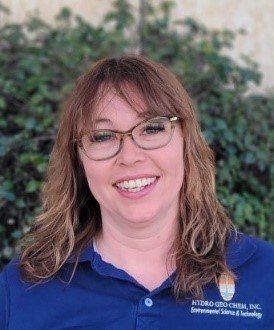
-M.A. Geography, University of Arizona, 2012 Representative Experience • Statewide Assessment & Remediation of Hazardous or Regulated Substances or Materials, Well Plug and Abandon Arizona: Project Manager, budget management and employee management. Records review, Environmental Data Reports with GIS figures, and environmental justice assessment for orphaned gas and oil wells in Mohave, La Paz, and Yavapai counties. Monthly federal data reports. Discovery field work, public outreach, and survey management to locate abandoned wells, with water, soil, and methane sampling of wells. Project manager for magnetometer drone survey with Parson’s engineering, surveying 80 well sites including coordinating to cover sites of four other consulting agencies. • Phase I Environmental Site Assessments: Complete onsite assessments, compile, and review database reports, analyze data and write reports, and deliver to clients. • GRIC Firebird Lake Environmental Analysis: Sampled water, soil, and underwater sediment by boat for SWCA Environmental Consulting. Wrote report on findings with recommendations on removing the lake water and sediment for interstate exchange development by ADOT. • Arizona Military Oversight Support Services, Sahuarita AFR-FUDS: Assist with project management tasks, analysis of property ownership, land use and environmental conditions, relational GIS analysis, and figures. • Skyline Services LUST Site, Yarnell, Arizona: Performed pilot groundwater pumping test, and deployed hydrasleeves for vertical column analysis. GIS analysis of benzene extent in groundwater, water elevations, and figures of analyte concentrations and physical parameters. • 1st and Hopi PI Site, Holbrook, Arizona: GIS analysis of benzene extent in soil and groundwater, water elevations, and figures of analyte concentrations and physical parameters. • Hwy 260 & Main WQARF Site, Cottonwood, Arizona: GIS analysis and figures of analyte concentrations from sampled groundwater from approximately 80 privately owned wells and 20 monitoring wells. • Stone and Drachman PI Site, Tucson, Arizona: Performed soil vapor sampling from temporary vapor probes; performed groundwater sampling for quantitative analyte analysis and insitu groundwater Color-Tec qualitative analysis. GIS analysis and figures of analyte concentrations. Well development. • 7th and Arizona, Tucson, Arizona: Soil vapor sampling. GIS analysis of benzene extent and water elevations, and figures of analyte concentrations and physical parameters in groundwater site wide. • Maple Street Bridge, Clayton, NM: Final report preparation. • Dolly Madison CA LUST Site, Tucson, Arizona: GIS analysis of benzene extent and water elevations, and figures of analyte concentrations and physical parameters. Groundwater sampling using low-flow bladder pump purge. Meetings for risk-based closure. • City of Tucson Landfill Groundwater Sampling, Tucson, Arizona: Deployed hydrasleeves and sampled groundwater at Tumamoc landfill, high-volume purge and sample at monitoring wells with insitu pumps at Irvington landfill. • City of Winslow VRP, Winslow, Arizona: GIS analysis of contaminant extent and water elevations. • Queen Creek Landfill, Queen Creek, Arizona: GIS analysis of contaminant extent and water elevations. • Winslow Whiting Bros. No. 23, Winslow, Arizona: GIS analysis of benzene extent and water elevations, and figures of analyte concentrations and physical parameters. • Miracle Mile WQARF Site, Tucson, Arizona: Figures for proposed soil vapor extraction system. • Energy Fuels, White Mesa, Utah: Converting Surfer data into GIS format for figures for reports. Previous Experience • National Park Service, Inventory and Monitoring Program, Tucson, Arizona: Project manager for assessing exotic plant distribution, abundance, and impact at Montezuma Castle and Tuzigoot National Parks. Project development of macroinvertebrates monitoring program. Hydrological research on the Gila River in New Mexico. Sampled monitoring wells in Arizona National Parks. Complete mapping and assessment of National Parks in Arizona and New Mexico for invasive species in culturally sensitive and riparian areas. GIS analysis and reporting of invasive species. Built website for data access. • Santa Cruz Watershed Collaborative, Tucson, Arizona: Assisted in development of a Watershed Restoration Plan for the Santa Cruz River that brought together federal agencies, municipal entities, county entities, tribal leaders, environmental nonprofits, and community members. Planned and implemented two planning forums per year. Lead on communications. Project manager for sub workgroup development on education and recreation. • City of Tucson, Tucson, Arizona: Served as primary water and environment lead in city council office. Advised political leaders on CAP, ADWR, and PAG actions. Worked with Citizens Water Advisory Committee, COT Water Department, and COT Environmental Services, along with community and neighborhood associations to develop planning for water supply, aquifer recharge, and landfill contamination affecting water supply. Political liaison to the TARP project. • Sky Island Alliance, Tucson, Arizona: Development project manager. Native plant restoration and invasive species removal on federal lands in Arizona and New Mexico. Leading volunteer groups. Communications lead. • California Department of Water Resources, Sacramento, California: Evaluated tree ring data and land use for each basin that provided a water source to municipalities’ state required drought contingency and water plans. Compared historical precipitation to municipal water plans to determine if their plans reflected estimated precipitation and storage volumes taking into account climate change conditions. • University of Arizona, Water Resources Research Center, Tucson, Arizona: Teaching middle school students riparian water systems biology and tools for hydrological research in outdoor learning labs, grades 5th to 8th. • University of Arizona, Soil, Water and Environmental Science, Tucson, Arizona: Research and development of surfactants on mica media, bioremediation research for Superfund sites. • Sonoran Institute, Tucson, Arizona: Biological assessments, and data processing for native species in riparian corridors. • University of Arizona, Renewable Natural Resources, Tucson, Arizona: Biologic assessment field research and mapping of invasive plant species on federal lands. • United States Fish and Wildlife Service, Lake Havasu, Arizona: Sampled monitoring wells. Hydrological research on water flow and storage from beaver dam ponds of the Bill Williams River. Biologic assessment of plants, and beaver populations. • University of Arizona, Geosciences, Tucson, Arizona: Used mass spectrometry for oceanic coral core samples to determine La Nina/El Nino paleoclimate conditions. Puplications -Ecological Restoration, 2008. Assessing exotic plant distribution, abundance, and impact at Montezuma Castle and Tuzigoot National Monuments in Arizona. Theresa Crimmins, Melissa Mauzy, and Sarah Studd
|

 Expertise